Before heading into the mountains check up-to-date trail info, & register your trek intentions with the National Park office in Bariloche, Pampa Linda or online.
Cerro Chall-Huaco Trek
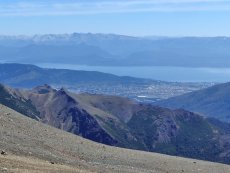
On the Eastern side of Bariloche and harder to get, there is no public transport & 14kms or gravelroad. It's a rewarding climb to the top of this 2088m summit with 360 degree views. You start at the site of the old Refugio Neumeyer that burnt down in 2014. Details of activities can be found here: https://www.facebook.com/refugio.neumeyer
Overview
| Duration: | 1 day |
| Distance: | 10 km's return |
| Ascent: | 700m |
| Start: | Refugio Neumeyer |
| Finish: | Refugio Neumeyer |
| Difficulty: | Medium |
| Access: | Hard - car or taxi |
| Park Entrance $: | None |
| Notes: | Great views / Summit |
The Route
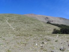
From the car park walk the 50m up the trail to the burnt down refuge and follow the signed trail south west as it gently ascends through the forest, past the 'Laguna de los Patos' to a junction where you can do a very short side trip (100m) to the Laguna Verde viewing platform (great views). Back on the main trail, it gets slightly steeper as it exits the forest and out onto the open mountain side. Continue following the cairns and markers up the ridge to the summit. Near the summit the markers are a little indistinct but the route to the summit is obvious. Return via the same trail. From the sumit of Chall-Huaco there is the possability to continue onto the mountain behind (Cerro Blanco). From Refugio Neumeyer to the summit of Chall-Huaco is about 2-3 hours one way.
Water: There is a small stream shortly before ascending above the tree-line.
Is the stream water safe to drink? As with any mountain region where lots of people trek, there will be pollution of water sources. The refuges provide safe drinking water; whilst out on the trails I would recommend treating water from streams. Recommended water filter: Sawyer Mini Filter (really small, practical & affordable!)
Camping / Mountain Huts
Check Out their Facebook PageTransport:
Having a car is really the only way to get there, but check the road conditions as it's 12 kms of gravel/mud road and not very accessible in the winter or when there is lots of rain. Taxi may be an option.


Map for Cerro Chall-Huaco Trek
The information contained on this website is no substitute for a qualified Mountain Guide and the site author accepts no responsibility for inaccurate or outdated information (nor omission of information), nor any accident or injury sustained while carrying out the treks described here. This website has no affiliation to any of the refuges, businesses or organisations named withing it. All times and distances are approximate.