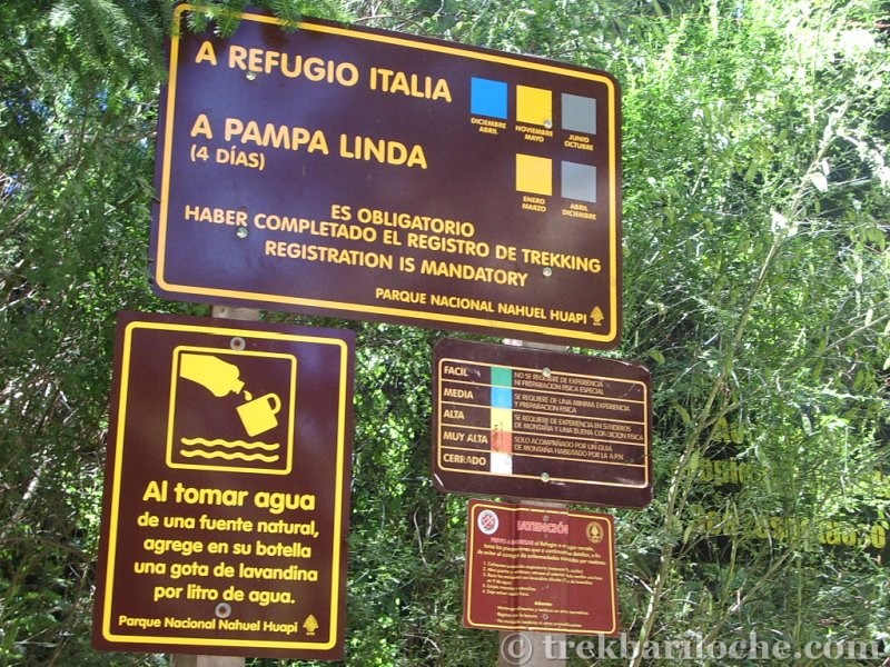
Before heading into the mountains check up-to-date trail info, & register your trek intentions with the National Park office in Bariloche, Pampa Linda or online.
Refugio Laguna Negra (also known as Refugio Manfredo Segre) Treks
A long walk in through a forested valley with a short sharp ascent to reach reach Refugio Lagua Negra on the shore of the lake with the same name.
Refugio Laguna Negra (Manfredo Segre)
Elevation: 1650m
Prices: See their website
Capacity: sleeps 60
Check their website for up to date details: https://www.refugiolagunanegra.com/
They even seem to accept reservations
Camping: Free (voluntary payment)
Contact details (from CAB website): Martín De Agostini - contacto@refugiolagunanegra.com - refugiolagunanegra@yahoo.com.ar https://www.refugiolagunanegra.com/ - (+54) 9 294 471-6476 / (+54) 9 294 460-3879
Refugio Laguna Negra Trekking Routes:
1) The Normal Route to Laguna Negra 
A beautiful forest walk with a steep zig zag trail leading out of the trees to the refugio and lake.
Overview
| Duration: | 5 hours one way |
| Distance: | 14 km's |
| Ascent: | 800m |
| Start: | Colonia Suiza |
| Finish: | Refugio Laguna Negra |
| Difficulty: | Easy |
| Access: | Medium - a public bus every few hours |
| Park Entrance $: | None |
| Notes: |
The Route
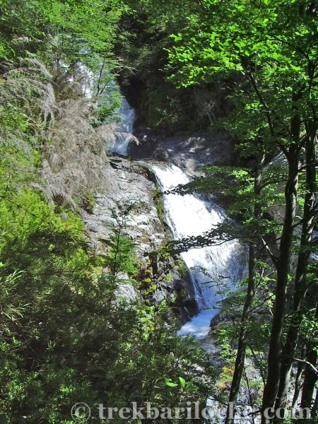
If arriving by bus you will probably be dropped off outside the local brewery 'Cerveceria Blest' the bus doesn't actually go into the center of Colonia Suiza (check before you travel). Walk along the road in a westerly direction, the start of the trail is about 200m on the left hand side, there is a sign post there. The first section of the trail climbs in the forest away from the valley floor along a gravel track. When the track ends take the smaller trail to the right (it's obvious) as it drops back down and joins the river. Continue along the trail as it follows the river for a couple of hours before arriving at a clearing in the forest. From here the trail starts to climb (look out at the waterfall on the right), crosses two small streams then starts a steeper ascent as it zig zags up to Refugio Laguna Negra.
Water
After the first 30 minutes the trail is within easy access to the Goye stream until the start of the zig-zags, so fill up before the final ascent to Refugio Laguna Negra.
Is the stream water safe to drink? As with any mountain region where lots of people trek, there will be pollution of water sources. The refuges provide safe drinking water; whilst out on the trails I would recommend treating water from streams. Recommended water filter: Sawyer Mini Filter (really small, practical & affordable!)
Transport:
Take bus number 10, there are only about 7 service per day. The bus stop for Colonia Suiza is outside of Cerveceria Berlina (Berlina Brewery), the bus doesn't actually go into the center of Colonia Suiza.
If arriving by car, it is best to park in the main street (it's actually a gravel road) in Colonia Suiza. Look out for the no parking signs - I think you are only supposed to park on one side of the road.
(Tap image to open gallery)


2) Refugio Laguna Negra to Refugio Lopez 
This is usually done the other way round see route here
3) Refugio Laguna Negra to Refugio Jakob 
This trek is best walked in the Refugio Jakob to Refugio Laguna Negra direction and not vica verca due to the descending the steeper screes and not ascending them. See the route here
Map for all Refugio Jakob Treks
The Normal Route to Laguna Negra ![]() | Refugio Laguna Negra to Refugio Lopez
| Refugio Laguna Negra to Refugio Lopez ![]() | Refugio Laguna Negra to Refugio Jakob
| Refugio Laguna Negra to Refugio Jakob ![]()
The information contained on this website is no substitute for a qualified Mountain Guide and the site author accepts no responsibility for inaccurate or outdated information (nor omission of information), nor any accident or injury sustained while carrying out the treks described here. This website has no affiliation to any of the refuges, businesses or organisations named withing it. All times and distances are approximate.