Before heading into the mountains check up-to-date trail info, & register your trek intentions with the National Park office in Bariloche, Pampa Linda or online.
Refugio Lopez Treks
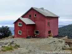
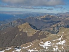
Refugio Lopez is closer to the road than any other refugio, its also the shortest walk in, but don't be fooled, it's steep climb from the outset, but you will be rewared with fantastic view once you climb above the treeline and even better views if you continue the ascent to Pico Turista a few hours above Refugio Lopez.
This refuge is privately owned so is not found on the Club Andino Bariloche website.
Refugio Lopez
(This hut is not operated by Club Andino Bariloche). It usually seems quite quiet & appears very clean.
Elevation: 1670m
Facebook page
Phone: +54 294 434-1194
Refugio Lopez Trekking Routes:
1) The Normal Route to Refugio Lopez 
Refugio Lopez is the closest to the road of all refugios so is the shortest trek. Once at the refugio you can climb the nearby peak of Pico Turista for amazing 360 deg views. - NOTE this involves some simple scrambling over the rocks allow 2 - 3 hours for this return trip from Refugio Lopez to Pico Turista.
Overview
| Duration: | 2 hours one way |
| Distance: | 6 km's |
| Ascent: | 770m (1100m including Pico Turista) |
| Start: | Arroyo Lopez |
| Finish: | Refugio Lopez |
| Difficulty: | Easy (Medium to ascend Pico Turista) |
| Access: | Medium - a public bus every few hours |
| Park Entrance $: | None |
| Notes: | Nice one day trek, great views |
The Route
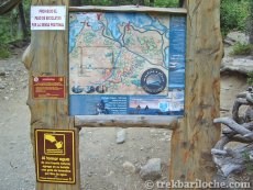
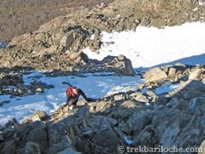
From the snack bar at Arroyo Lopez follow the well marked trail as it zig zags up the hill. After about an hour you reach a 4x4 track. Follow this until you cross a small stream and continue following the well marked trail until you reach Refugio Lopez. From the refugio there is a fairly well marked trail that ascends over steep rocky ground (use of hands needed) to Pico Turista a small summit with 360 deg views. Ask at the refugio about the trail before heading up.
Water
One possible small stream shortly before arriving at the refuge Lopez (subject to the season). If continuing on up to the summit there is a small lake/stream about half way up.
Is the stream water safe to drink? As with any mountain region where lots of people trek, there will be pollution of water sources. The refuges provide safe drinking water; whilst out on the trails I would recommend treating water from streams. Recommended water filter: Sawyer Mini Filter (really small, practical & affordable!)
Transport:
Take bus number 10, there are only about 7 service per day. The bus stop for Colonia Suiza is outside of Cerveceria Berlina (Berlina Brewery), the bus doesn't actually go into the center of Colonia Suiza.
If arriving by car you can park on the side of the road by the snack bar at Arroyo Lopez. NOTE: There have been break-in of vehicles parked here. Try not to leave your vehicle overnight or after the snack bar closes.
(Tap image to open gallery)


2) Refugio Lopez to Refugio Laguna Negra 
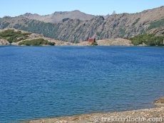
This trek can be done in either direction. Great mountain scenery with views across to Cerro Tronador.
Overview
| Duration: | 6 hours one way |
| Distance: | 10km |
| Ascent: | 600m |
| Start: | Refugio Lopez / Laguna Negra |
| Finish: | Laguna Negra / Refugio Lopez |
| Difficulty: | Easy (Medium to ascend Pico Turista) |
| Access: | Medium - a public bus every few hours |
| Park Entrance $: | None |
| Notes: | Can be trekked in either direction |
The Route
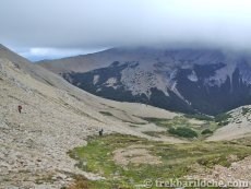
Can be walked in either direction, although it is easier in the direction: Lopez > Laguna Negra as you will descent the loose scree section rather than ascent it. There is a section of easy scrambling on the ascent of Pico Turista (above Refugio Lopez) and a very small section where there are some ropes to help you traverse a rocky section near Laguna Negra.
Water
The only guaranteed water source between the two Refugio is the stream in the Goye valley.
Is the stream water safe to drink? As with any mountain region where lots of people trek, there will be pollution of water sources. The refuges provide safe drinking water; whilst out on the trails I would recommend treating water from streams. Recommended water filter: Sawyer Mini Filter (really small, practical & affordable!)
(Tap image to open gallery)




Map for all Refugio Jakob Treks
The Normal Route to Refugio Lopez ![]() | Refugio Lopez to Refugio Laguna Negra
| Refugio Lopez to Refugio Laguna Negra ![]()
The information contained on this website is no substitute for a qualified Mountain Guide and the site author accepts no responsibility for inaccurate or outdated information (nor omission of information), nor any accident or injury sustained while carrying out the treks described here. This website has no affiliation to any of the refuges, businesses or organisations named withing it. All times and distances are approximate.